 Using remote sensing to quantify carbon capture capacity in wetlands
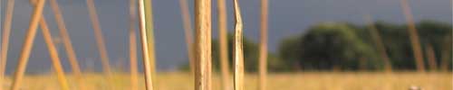
Peatlands represent 16-33% of the global soil carbon pool. Temperate peatlands –typically dominated by grasses and sedges such as cattail & tule – generate among the greatest annual rates of net primary productivity (NPP, up to 8 kg m2) and soil carbon storage (up to 3 kg m2) for natural ecosystems. Belowground tissues represent 20-80% of total NPP, thus understanding belowground NPP (BNPP) in these wetland ecosystems is particularly important. Under optimal conditions to minimize methane emissions, peat or soil carbon sequestration in restored temperate peatlands may serve an important role in large-scale carbon storage. Remote sensing techniques hold great potential for long-term monitoring of changes in wetland area and carbon stocks.
 In conjunction with Kristin Byrd at the USGS who was awarded a NASA New Investigator Project Award to look at advanced remote sensing to quantify temperate peatland capacity for belowground carbon capture in restored wetlands around the SF Bay area.
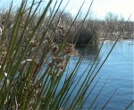
Field work. Our work focused on Twitchell Island, covered by Typha and Schoenoplectus, where we developed a retrospective of the Twitchell Island wetland site using historic remote sensing and field data.
Our second aim was to develop protocols for belowground biomass core sampling using in-growth bags. Other field measures included: allometric aboveground biomass sampling using a 0.11 meter square quadrat, leaf surface CO2 exchange, assimilation efficiency, leaf fluorescence; photosynthetically active radiation above and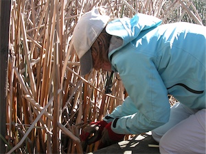 kristin at work at twitchell below canopy with a PAR sensor to estimate absorbed photosynthetically active radiation (APAR).
These field measures were be compared with field spectrometer readings collected at coring locations twice a month. Readings were taken in pure tule and pure cattail stands. These data were analyzed to identify indices related to biomass, light use efficiency, fraction of absorbed photosynthetically active radiation (fAPAR), 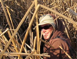 lisa in the reedschlorophyll.
Remote sensing. Our final aim was to scale these relationships up using remote sensing. In order to scale up the field spectrometer data, we used NASA and commercial satellite data to scale up vegetation indices derived from field spectrometer data. Imagery included NASA Hyperion or Digital Globe World View-2.
Kristin Byrd, Jessica O'Connell, Stefania Di Tommasso, and Lisa Schile have been involved in this project. I've posted some photos of recent field work here. Papers from this project are here.