 Our Space: A Neighborhood Database
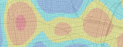
Genetic, social, and environmental conditions shape individual health, but it can be difficult to discern the influence of the many interacting variables. The Our Space project is exploring spatial analysis methods to better understand the factors that contribute to various health outcomes. The Kelly Lab is collaborating with Barbara Laraia in Public Health, and we are constructing a spatial database to provide contextual information regarding the social, food, and physical environments. Using this database, we are conducting geospatial analysis and developing variables to characterize neighborhood factors that may contribute to health risks. Once completed, the database will support three health-related projects, including a project funded by the National Institutes of Health (NIH) to study diabetes.
Diabetes is of growing concern to health researchers, as prevalence of the disease has doubled in the past two decades and is the fifth leading cause of death, despite being considered largely preventable. Racial disparities in diabetes prevalence and complications are notable, but are not fully understood; it appears that unmeasured environmental variables, such as access to food and physical activity venues, may contribute to these differences. The Our Space project is utilizing longitudinal data sets to assess the complex relationship between environmental variables and markers of diabetes risk. This project is one of the largest of its type, including a sample size of over 300,000 from across Kaiser’s service area. By applying innovative spatial analysis methods to the large study group, Our Space hopes to better explain the causes of disparities in diabetes incidence.
Our Space has assembled a diverse team of researchers to explore this topic. This collaborative project is comprised of members from Kaiser Permanente Division of Research (DOR), University of California San Francisco, and University of California Berkeley, with backgrounds in public health, nutritional epidemiology, geography, economics, and statistics. Through this collaborative effort, Our Space will build upon a rich collection of pre-existing data from previous and ongoing studies, while introducing various spatial variables to expand upon this research. Through this work, Our Space seeks to develop improved methodologies for health researchers to integrate spatial information into their analyses.
Collaborators
- UC Berkeley School of Public Health
- Kaiser Permanente Division of Research - Diabetes Study of Northern California (DISTANCE)
A long-term research program examining social disparities in diabetes-related health outcomes with epidemiological and health services research in diabetes among a large, multiethnic cohort of patients in a large integrated healthcare delivery system. - UCSF Center for Obesity Assessment, Study & Treatment (COAST)
A multidisciplinary research center investigating the influence of psychosocial stressors on metabolism, eating behavior and nutrition, physical activity, fat distribution, and weight gain. - UCSF Department of Epidemiology & Biostatistics
Study Area
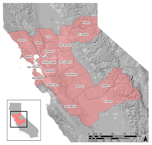 Our Space 19 County Primary Study Area
Data
A summary of the currently compiled and completed datasets and contextual variables in the Our Space neighborhood database is available here to download as a pdf.
Current Sub-Projects
- Our Space Neighborhood Database
A longitudinal database to characterize neighborhoods for research examining the intersection of neighborhood environment characteristics and individual health outcomes. This includes neighborhood access to nutritional food sources, physical activity resources, and social amenities and neighborhood accessibility, walkability, safety, and pollution exposure. - Walkability and Accessibly Index
A walkability and accessibility index to estimate neighborhood connectivity and walking and transportation environments. - Neighborhood Deprivation Index
A longitudinal socioeconomic index comprising income/poverty, education, employment, housing, and occupation variables. - Kaiser Patient and Neighborhood Mobility
A project assessing patient mobility throughout time and changes in neighborhood characteristics and individual health outcomes.
Recent Publications
For more please see the Kelly Lab publication page here.
Related Information
- California Environmental Health Tracking Program (CEHTP)
A collaborative initiative of the Division of Environmental and Occupational Disease Control (DEODC) of the California Department of Public Health (CDPH), the Office of Environmental Health Hazard Assessment (OEHHA) of the California Environmental Protection Agency (Cal/EPA), and the University of California. They work to develop advanced GIS datasets and models to identify populations most vulnerable to environmental hazards, such as pesticides and air pollution. - Network for a Healthy California - GIS Map Viewer
An interactive, internet-based Geographic Information System (GIS) that allows users to view and query mapped nutrition data. - UCLA Center for Neighborhood Knowledge
The Neighborhood Knowledge California (NKCA) Distributed Community Platform is a webGIS application that enables users to upload and save their own data. - USDA Food Access Research Atlas
An interactive, internet-based Geographic Information System (GIS) that allows users to view and query food-desert census tracts as defined by the Healthy Food Financing Initiative (HFFI). Created by the USDA Economic Research Service. - USDA Food Environment Atlas
An interactive, internet-based Geographic Information System (GIS) that allows users to view and query food environment factors such as store and restaurant proximity, food prices, food and nutrition assistance programs, and community characteristics. Created by the USDA Economic Research Service. - ESRI Food Desert Locator
An interactive, internet-based Geographic Information System (GIS) that allows users to view populations in poverty who live beyond a one mile walk to a supermarket. Created by ESRI. - Community Commons
An interactive mapping, networking, and education utility for healthy, sustainable, and livable community initiatives. Includes access to free data, mapping and visualization tools, local community initiatives, and forums. Created by Advancing the Movement and the Institute for People, Place and Possibilities (IP3). - CityFood Working Group
The UC Berkeley urban food systems working group provides a forum for researchers, students, and the public to discuss issues related to urban agriculture and urban food systems. Sponsors speakers, lectures, and workshops and provides links to local and national urban food related resources. - Healthy Food Access Portal
Created by the PolicyLink, The Food Trust, and The Reinvestment Fund and funded by the Robert Wood Johnson Foundation. A central portal for finding resources to improve healthy food access in communities.
For related blog entries please see the Kelly Lab blog here.
Ellen Kersten and Sam Blanchard are working on this project.