New paper: Mapping forest fuel treatments using Lidar
Su, Y, Q Guo, B M Collins, D L Fry, T Hu, and M Kelly. 2016. Forest fuel treatment detection using multi-temporal airborne lidar data and high-resolution aerial imagery: a case study in the Sierra Nevada Mountains, California. International Journal of Remote Sensing 37(14): DOI: 10.1080/01431161.2016.1196842
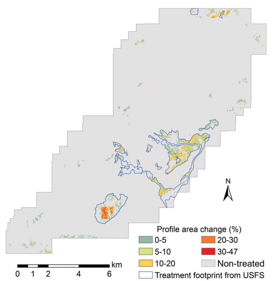 Forest change detection using lidarTreatments to reduce forest fuels are often performed in forests to enhance forest health, regulate stand density, and reduce the risk of wildfires. Although commonly employed, there are concerns that these forest fuel treatments (FTs) may have negative impacts on certain wildlife species. Often FTs are planned across large landscapes, but the actual treatment extents can differ from the planned extents due to operational constraints and protection of resources (e.g. perennial streams, cultural resources, wildlife habitats). Identifying the actual extent of the treated areas is of primary importance to understand the environmental influence of FTs. Light detection and ranging (lidar) is a powerful remote-sensing tool that can provide accurate measurements of forest structures and has great potential for monitoring forest changes. This study used the canopy height model (CHM) and canopy cover (CC) products derived from multi-temporal airborne laser scanning (ALS) data to monitor forest changes following the implementation of landscape-scale FT projects. Our approach involved the combination of a pixel-wise thresholding method and an object-of-interest (OBI) segmentation method. We also investigated forest change using normalized difference vegetation index (NDVI) and standardized principal component analysis from multi-temporal high-resolution aerial imagery. The same FT detection routine was then applied to compare the capability of ALS data and aerial imagery for FT detection. Our results demonstrate that the FT detection using ALS-derived CC products produced both the highest total accuracy (93.5%) and kappa coefficient (κ) (0.70), and was more robust in identifying areas with light FTs. The accuracy using ALS-derived CHM products (the total accuracy was 91.6%, and the κ was 0.59) was significantly lower than that using ALS-derived CC, but was still higher than using aerial imagery. Moreover, we also developed and tested a method to recognize the intensity of FTs directly from pre- and post-treatment ALS point clouds.
 forests, lidar, remote sensing, snamp