IGIS exploring applications of drones for UC Agriculture and Natural Resources
 Tuesday, March 8, 2016 at 11:01AM
 IGIS is excited to be working with 3D Robotics (3DR) to explore new applications of small unmanned aerial systems (sUAS) for monitoring agriculture and natural resources. This technology has never been more practical for scientific exploration; however, there is still much to be learned about how to best utilize sUAS in this way.
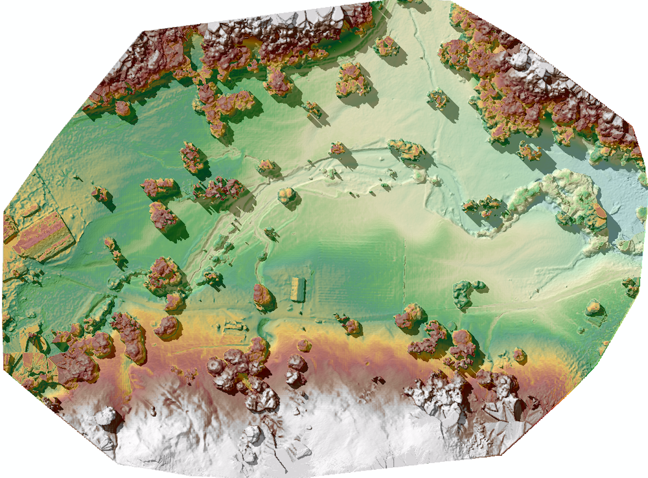
 DEM from drone flightIGIS is now developing protocols for safe and efficient deployment of a 3DR Solo sUAS. Equipped with a common 12 megapixel GoPro Hero camera, this platform can survey up to 75 acres, at 3 inches of spatial resolution in less than 20 minutes, while flying a pre-defined flight path at 23 miles per hour, at 300 feet above ground level. Then thanks to Pix4D mapping software, which is used to combine the pictures collected by the sUAS's GoPro into a single image mosaic, automated photogrammetric processes can render a digital terrain model from the images with a vertical accuracy close to the same 3 inches spatial resolution found in the original image collection.
IGIS has introduced sUAS and remote sensing training into our workshop schedule for this year. Please check out our IGIS training calendar by Clicking Here for more information.
 Maggi | in
  class,
  remote sensing,
  uav |
uav |