Searching for patterns in high res imagery: template matching
From two friends in the space of a week! While I was away, this tool made the rounds:
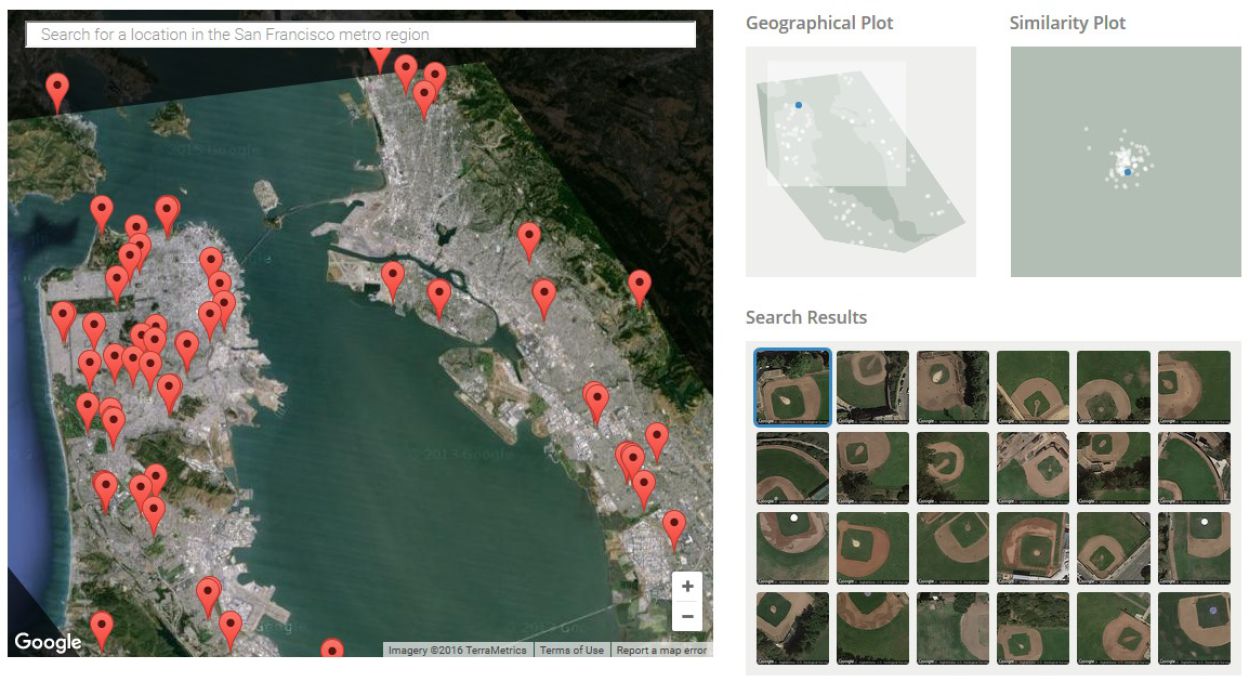
http://sf.terrapattern.com/: This is the alpha version of Terrapattern, a visual search tool for satellite imagery. The project provides journalists, citizen scientists, and other researchers with the ability to quickly scan large geographical regions for specific visual features.
It is a great deal like some of the template matching routines in Definiens Ecognition among other proprietary software tools.
Here is an article about it: http://techcrunch.com/2016/05/25/terrapattern-is-a-neural-net-powered-reverse-image-search-for-maps/
They say:
Terrapattern is a visual search engine that, from the first moment you use it, you wonder: Why didn’t Google come up with this 10 years ago? Click on a feature on the map — a baseball diamond, a marina, a roundabout — and it immediately highlights everything its algorithm thinks looks like it. It’s remarkably fast, simple to use and potentially very powerful.
Go ahead and give it a try first to see how natural it is to search for something. How does that work? And how did a handful of digital artists and developers create it — and for under $35,000?
The secret, as with so many other interesting visual computing projects these days, is a convolutional neural network. It’s essentially an AI-like program that extracts every little detail from an image and looks for patterns at various levels of organization — similar to how our own visual system works, though the brain is infinitely more subtle and flexible.
 Maggi
Maggi