Digitizing old maps for science: the Soil-Vegetation Map Series
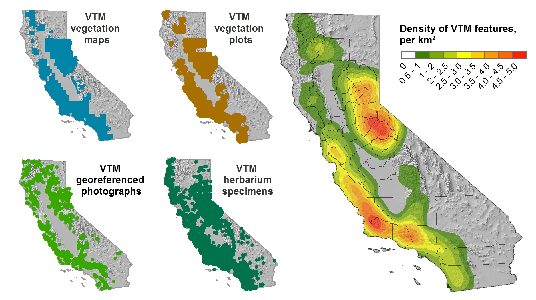
As many of you know, my lab at Berkeley has been involved in rescuing, digitizing and sharing historical ecological data for about a decade. Our big push has been working with the Wieslander Vegetation Type Mapping (VTM) project in California. The VTM collection, created in the 1920s and 1930s, has been described as “the most important and comprehensive botanical map of a large area ever undertaken anywhere on the earth’s surface” (Jepson et al. 2000). It was pioneered by Albert E Wieslander, an employee of the Forest Service Forest and Range Experiment Station in Berkeley, CA. Overall, the collection covers about 28 million ha or just over a quarter of the state including natural areas exclusive of the deserts and the larger agricultural areas. The collection includes over 200 vegetation maps, 18,000 vegetation plots, over 3,000 photographs, and over 100 plant voucher specimens. It is a detailed, extensive (although not complete), and multi-modal description of the vegetation of California in the early 20th century, and its availability in digital form presents multiple opportunities to examine, characterize and understand changes to California landscapes. Many groups around the state have helped in the digitization, and now the four parts of the collection are reunited in digital space. Here is a nice pic of their coverage in the state.
The data has been used in many scientific publications, but one of the VTM projects under-sung roles has been to provide a foundation for many subsequent mapping efforts in the state. For example, the protocols developed by Wieslander and his crew became the foundation for the State Cooperative Soil-Vegetation surveys from that covered 4.6 million ha of land during 1947-1977. Those early surveys paved the way for many of the contemporary vegetation classification schemes used today in California, including the Manual for California Vegetation, the National Vegetation Classification System, and the California Gap Analysis Program.
The maps from the State Cooperative Soil-Vegetation Survey of California, which are the first state-wide program to use aerial photography interpretation to produce vegetation and timber maps, have not to our knowledge been digitized, and might add to the understanding of California flora in the post-war period. We are about to embark on a pilot project to examine the feasibility of digitizing and georeferencing these soil-vegetation maps, and adding them to the digital collection. I think the georeferencing process will have to be just an attribution of the marked corner coordinates. Stay tuned! Here are some snap shots so you know what we are up against.
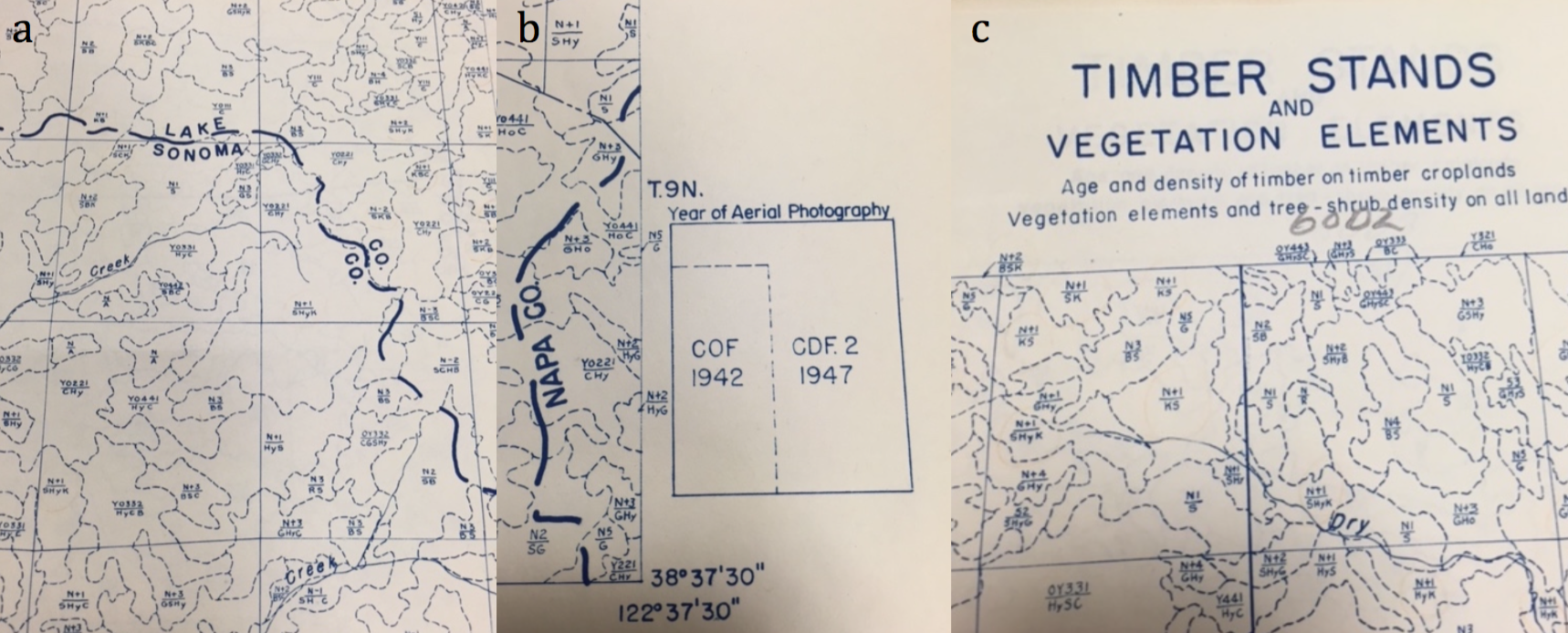 Map examples: a) detail of veg polygons; b) index indicating year of aerial photo used; c) example from timber series of maps Fore more about the VTM project, see my blog posts here, and the vtm.berkeley.edu website.
 Maggi
Maggi