blog authors
past blog entries

Welcome to the Kellylab blog

geospatial matters

Please read the UC Berkeley Computer Use Policy. Only members can post comments on this blog.

Wednesday
Jul302008

Garmin puts Nuvifone on hold till W09

Bummer, I was thinking about getting the G3 iPhone, but I wanted to try the Garmin's Nuvifone first...looks like I'll have to wait.  Either way I hope society is ready to deal with the "spatial" revolution. Cheers, Josh

Monday
Jul282008

GPS on a Mac

I have been doing some GIS noodling on my Mac recently, since it is an Air and very nice. So, what can you do without parallels on a Mac? Lots. The new QGIS with Grass plugins is great, but if you want to just get your hiking points in and overlaid on an image, you can use GPSbabel. Also free (with suggested donations though, and it is a good thing). You can download your waypoints, tracks and routes from your Garmin (I used a GPSMap 60CSx) with GPSbabel (use the GPX format) and use the GPS plugin in QGIS to easily map them. But, going the other way? that is more difficult. I used GPSbabel with csv format (x, y, id) and uploaded an important route to my Garmin. I was feeling all adventurous until a colleague sent me this link: ben sinclair's site: how to use a garmin with your mac which sorts it all out for you.
Saturday
Jul262008

Radar vs GPS: GPS Wins!!!

 A 16 year kid got a speeding ticket for 62 in a 45, but the GPS tracking device in his parents put in the car showed his more accurate speed, first the court ruled against him, but when the "expert" realized the GPS was accurate to 1mph of the speed, they overturned it. http://hothardware.com/News/Speeding_Radar_Gun_vs_GPS/

Tuesday
Jul152008

Radiohead uses LiDAR in latest music video

No cameras or lights were used. Instead two technologies were used to capture 3D images: Geometric Informatics and Velodyne LIDAR. Geometric Informatics scanning systems produce structured light to capture 3D images at close proximity, while a Velodyne Lidar system that uses multiple lasers is used to capture large environments such as landscapes. In this video, 64 lasers rotating and shooting in a 360 degree radius 900 times per minute produced all the exterior scenes. And here's the 'making of' video:

Tuesday
Jul152008

Fire Resources

A list of fire resources for CA (and other) fires:
Tuesday
Jul082008

Fire Imagery

Nice current images from NASA's Unmanned Aerial Vehicle: http://geo.arc.nasa.gov/sge/WRAP/current/wsfm08.html
Friday
Jun272008

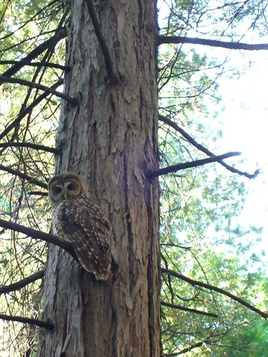
Watching closely


Watching closely, originally uploaded by SNAMP Photo Collector.

Marek found this fellow watching him on the way home from field work.

Wednesday
Jun252008

Google Map Maker!

Finally! http://www.google.com/mapmaker

Wednesday
Jun252008

Manifold GIS

These guys seem to think they got the best GIS, maybe the GIIF should try a license out? http://www.manifold.net/index.shtml Cheers, Josh

Wednesday
Jun252008

So smoky here

You know why: All the burning in Northern California is shown via the NASA hazards site. I haven't seen any perimeter maps yet.