publications by year

Selected Publications

My CV can be found here, my Google Scholar page is here and my Research Gate page is here. Links to directly downloadable papers are provided when possible - these are for individual use only; links to journals are also provided, but might not be available to users without campus library access. All papers are available upon request.

Entries in nasa (3)

Monday
May052014

Mapping wetland biomass with three remote sensors

Byrd, K.B., J.L. O'Connell, S. Di Tommaso, and M. Kelly. 2014. Evaluation of sensor types and environmental controls on mapping biomass of coastal marsh emergent vegetation. Remote Sensing of Environment 149: 166-180

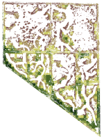
One of our biomass maps, this one from Mayberry slough

We modeled biomass of emergent vegetation with field spectrometer and satellite data from Landsat, Hyperion and WorldView-2 sensors. Use of narrowbands did not significantly improve biomass predictions over broadbands. Water inundation interacting with plant structure controlled biomass model accuracy. Shortwave infrared bands and multi-temporal datasets improved biomass prediction. These types of maps will track Blue Carbon, sea level rise and land use effects in coastal marshes.

Pdf download. Journal link.

Key words: emergent vegetation, hyperspectral sensor, field spectroscopy, multispectral sensor, water inundation, Blue Carbon, wetland management, error reporting.

Monday
Mar102014

Using remote sensing to model biomass accumulation in a wetland plant

Some of the reflectance spectra for S. acutusO’Connell, J.L., K.B. Byrd, M. Kelly. 2014. Remotely-sensed indicators of N-related biomass allocation in Schoenoplectus acutus. PLOS One. 9(3):e90870

Coastal marshes depend on belowground biomass of roots and rhizomes to contribute to peat and soil organic carbon, accrete soil and alleviate flooding as sea level rises. For nutrient-limited plants, eutrophication has either reduced or stimulated belowground biomass depending on plant biomass allocation response to fertilization. Within a freshwater wetland impoundment receiving minimal sediments, we used experimental plots to explore growth models for a common freshwater macrophyte, Schoenoplectus acutus. We used N-addition and control plots (4 each) to test whether remotely-sensed vegetation indices could predict leaf N concentration, root:shoot ratios and belowground biomass of S. acutus. N-addition did not alter whole plant, but reduced belowground biomass 36% and increased aboveground biomass 71%. We correlated leaf N concentration with known N-related spectral regions using all possible normalized difference (ND), simple band ratio (SR) and first order derivative ND (FDN) and SR (FDS) vegetation indices.

Click to read more ...

Tuesday
Feb052013

Plant litter influences remote sensing signatures in wetlands

Correlation between fAPAR-hig and two-band vegetation indices usingsimulated Hyperion bands using spectroradiometer data collected at Twitchell IslandSchile, L. K. Byrd, L. Windham-Myers, and M. Kelly. 2013. Accounting for plant litter in remote sensing based estimates of carbon flux in wetlands.  Remote Sensing Letters 4(6):542-551

Monitoring productivity in coastal wetlands is important due to their high carbon sequestration rates and potential role in climate change mitigation. We tested agricultural- and forest-based methods for estimating the fraction of absorbed photosynthetically active radiation (ƒAPAR), a key parameter for modeling gross primary productivity (GPP), in a restored, managed wetland with a dense litter layer of non-photosynthetic vegetation, and we compared the difference in canopy light transmission between a tidally influenced wetland and the managed wetland.

Click to read more ...