publications by year

Selected Publications

My CV can be found here, my Google Scholar page is here and my Research Gate page is here. Links to directly downloadable papers are provided when possible - these are for individual use only; links to journals are also provided, but might not be available to users without campus library access. All papers are available upon request.

Entries in error (5)

Thursday
Dec182014

The need to validate remote sensing of crime

Kelly, A. and M. Kelly. 2014. Validating the remotely sensed geography of crime: a review of emerging issues. Remote Sensing 6(12): 12723-12751

This paper explores the existing literature on the active detection of crimes using remote sensing technologies.  The paper reviews sixty-one studies that use remote sensing to actively detect crime.  Considering the serious consequences of misidentifying crimes or sites of crimes (e.g. opening that place and its residents up to potentially needless intrusion, intimidation, surveillance, or violence), the authors were surprised to find a lack of rigorous validation of the remote sensing methods utilized in these studies.

Click to read more ...

Monday
May052014

Mapping wetland biomass with three remote sensors

Byrd, K.B., J.L. O'Connell, S. Di Tommaso, and M. Kelly. 2014. Evaluation of sensor types and environmental controls on mapping biomass of coastal marsh emergent vegetation. Remote Sensing of Environment 149: 166-180

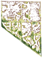
One of our biomass maps, this one from Mayberry slough

We modeled biomass of emergent vegetation with field spectrometer and satellite data from Landsat, Hyperion and WorldView-2 sensors. Use of narrowbands did not significantly improve biomass predictions over broadbands. Water inundation interacting with plant structure controlled biomass model accuracy. Shortwave infrared bands and multi-temporal datasets improved biomass prediction. These types of maps will track Blue Carbon, sea level rise and land use effects in coastal marshes.

Pdf download. Journal link.

Key words: emergent vegetation, hyperspectral sensor, field spectroscopy, multispectral sensor, water inundation, Blue Carbon, wetland management, error reporting.

Monday
Mar312014

What is "marginal land"? a review of the ways GIS is used to model (and define) "marginal land" for biofuel production

Lewis, S. and M. Kelly. 2014. Mapping the potential for biofuel production on marginal lands: differences in definitions, data and models across scale. International Journal of Geo-Information 3(2), 430-459; doi:10.3390/ijgi3020430

As energy policies mandate increases in bioenergy production, new research supports growing bioenergy feedstocks on marginal lands. Subsequently there has been an increase in published work that uses Geographic Information Systems (GIS) to map the availability of marginal land as a proxy for bioenergy crop potential. However, despite the similarity in stated intent among these works a number of inconsistencies remain across studies that make comparisons and standardization difficult. We reviewed a collection of recent literature that mapped bioenergy potential on marginal lands at varying scales, and found that there is no common working definition of marginal land across all of these works. Specifically we found considerable differences in mapped results that are driven by dissimilarities in definitions, model framework, data inputs, scale and treatment of uncertainty.

Click to read more ...

Friday
Oct312008

Historic map analysis: spatial error in the CA VTM dataset

Kelly, M., K. Ueda and B. Allen-Diaz. 2008. Considerations for ecological reconstruction of historic vegetation: Analysis of the spatial uncertainties in the California Vegetation Type Map dataset. Plant Ecology 194 (1): 37-49

Uncertainty surrounding plot centersWe examine the spatial uncertainties associated with 18,000 vegetation plots in the VTM dataset that has been digitized for use in modern ecological analysis. We examine the relationship between plot location error and basemap year, basemap scale, plot elevation, plot slope, and general plot habitat type. Pdf download. Journal link.

Keywords: CART . Historical vegetation data . Spatial error . VTM

Friday
Aug312001

Spatial accuracy assessment of wetland permits

Kelly, 2000. Cartography and Geographic Information Systems. A collection of permits granted for alterations to coastal wetlands in North Carolina from 1984 through 1992 was examined to determine the spatial accuracy of the data.

Click to read more ...