publications by year

Selected Publications

My CV can be found here, my Google Scholar page is here and my Research Gate page is here. Links to directly downloadable papers are provided when possible - these are for individual use only; links to journals are also provided, but might not be available to users without campus library access. All papers are available upon request.

Entries in spatial analysis (16)

Tuesday
Dec092014

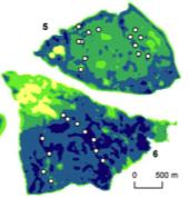
Spatial pattern of BMI among adults in Northern California 

Laraia, B. A., S. D. Blanchard, A. J. Karter, J. C. Jones-Smith, M. Warton, E. Kersten, M. Jerrett, H. H. Moffet, N. Adler, D. Schillinger, and M. Kelly. 2014. Spatial pattern of Body Mass Index among adults in the Diabetes Study of Northern California (DISTANCE). International Journal of Health Geographics 13:48 doi:10.1186/1476-072X-13-48

clustering of high and low BMIThe role that environmental factors, such as neighborhood socioeconomics, food, and physical environment, play in the risk of obesity and chronic diseases is not well quantified. Understanding how spatial distribution of disease risk factors overlap with that of environmental (contextual) characteristics may inform health interventions and policies aimed at reducing the environment risk factors.

Click to read more ...

Monday
Mar312014

What is "marginal land"? a review of the ways GIS is used to model (and define) "marginal land" for biofuel production

Lewis, S. and M. Kelly. 2014. Mapping the potential for biofuel production on marginal lands: differences in definitions, data and models across scale. International Journal of Geo-Information 3(2), 430-459; doi:10.3390/ijgi3020430

As energy policies mandate increases in bioenergy production, new research supports growing bioenergy feedstocks on marginal lands. Subsequently there has been an increase in published work that uses Geographic Information Systems (GIS) to map the availability of marginal land as a proxy for bioenergy crop potential. However, despite the similarity in stated intent among these works a number of inconsistencies remain across studies that make comparisons and standardization difficult. We reviewed a collection of recent literature that mapped bioenergy potential on marginal lands at varying scales, and found that there is no common working definition of marginal land across all of these works. Specifically we found considerable differences in mapped results that are driven by dissimilarities in definitions, model framework, data inputs, scale and treatment of uncertainty.

Click to read more ...

Wednesday
Nov162011

Where will SF Bay wetlands be in 100 years?

Stralberg, D., M. Brennan, J. C. Callaway, J. K. Wood, L. M. Schile, D. Jongsomjit, M. Kelly, V. T. Parker, and S. Crooks. 2011. Evaluating tidal marsh sustainability in the face of sea-level rise: a hybrid modeling approach applied to San Francisco Bay. PLoS ONE 6(11): e27388.

Tidal marshes will be threatened by increasing rates of sea-level rise (SLR) over the next century. Managers seek guidance on whether existing and restored marshes will be resilient under a range of potential future conditions, and on prioritizing marsh restoration and conservation activities. Building upon established models, we developed a hybrid approach that involves a mechanistic treatment of marsh accretion dynamics and incorporates spatial variation at a scale relevant for conservation and restoration decision-making. We applied this model to San Francisco Bay, using best-available elevation data and estimates of sediment supply and organic matter accumulation developed for 15 Bay subregions.

Click to read more ...

Wednesday
May122010

Predicting bird abundance in tidal marshes

Predicted mean abundance for common yellowthroat at Browns Is. and Sherman Lake

Stralberg, D., M. Herzog, N. Nur, K. Tuxen, S. Siegel and M. Kelly. 2010. Predicting avian abundance within and across tidal marshes using fine-scale vegetation and geomorphic metrics. Wetlands 30: 475-487

We used a blend of fine-scale remote sensing products and field-based survey data via spatial predictive models to aid in monitoring restoring tidal marshes for bird habitat. We developed a suite of 1-m pixel-level spatial metrics describing patterns in marsh vegetation and geomorphology for six sites across a large salinity gradient, and used these to predict avian abundance.

Click to read more ...

Tuesday
Dec012009

Interactions among wildland fires in the Sierra Nevada

Collins, B., J. Miller, M. Kelly, J.W. van Wagtendonk, and S. L. Stephens. 2009. Interactions among wildland fires in a long-established Sierra Nevada natural fire area. Ecosystems 12(1): 114-128. DOI: 10.1007/s10021-008-9211-7

We investigate interactions between successive naturally occurring fires, and assess to what extent the environments in which fires burn influence these interactions.

Click to read more ...

Wednesday
Dec312008

Spatial pattern dynamics of oak mortality & disease symptoms

Kelly et al. 2008. Journal of Forest Research. We used two-dimensional spatial analysis tools with data gathered in point-centered-quarter format in 2001 and 2004 to quantify 1) population density of the disease through time; 2) spatial pattern of tree mortality across scales through time; and 3) spatial co-occurrence of disease symptoms with crown mortality through time.

Click to read more ...

Sunday
Jun292008

Fire occurrence probability in Spain

Lozano et al. 2008. Remote Sensing of Environment. This research explores the relationships between fire occurrence and several families of environmental factors at different spatial observation scales by means of classification and regression tree models. Predictors accounting for vegetation status (estimated by spectral indices derived from Landsat imagery), fire history, topography, accessibility and vegetation types were included in the models of fire occurrence probability.

Click to read more ...

Wednesday
Oct312007

Spatial‐temporal tree mortality patterns associated with SOD

Liu, et al. 2007. Forest Ecology and Management. Inhomogeneous cross-K-functions of SOD and California bay trees: the peak in the dark line indicates co-clusteringWe analyzed the spatial–temporal patterns of overstory oak tree mortality in China Camp State Park, CA over 4 years using the point patterns mapped from high spatial resolution remotely sensed imagery. Both univariate and multivariate spatial point pattern analyses were performed (inhomogeneous K-functions and Neyman–Scott point processes) to characterize the spatial dependence among dead oak trees in each year, and between dead oaks and CA bay trees.

Click to read more ...

Monday
Apr302007

Spatial pattern of fires in the Sierra Nevada

Collins, B. M., M. Kelly, J. W. V. Wagendonk and S. L. Stephens. 2007. Landscape Ecology. Mapped fire severityWe use gridded estimates of fire severity, derived from Landsat ETM+ imagery, to identify the biotic and abiotic factors contributing to the observed spatial patterns of fire severity in two large natural fires. Regression tree analysis indicates the importance of weather, topography, and vegetation variables in explaining fire severity patterns between the two fires.

Click to read more ...

Thursday
Aug312006

Spatial analysis of air toxics in West Oakland, CA

Fisher, et al. 2006. Health and Place. This paper examines the spatial point pattern of industrial toxic substances and the associated environmental justice implications in the San Francisco Bay Area, California, USA. Using a spatial analysis method called Ripley’s K we assess environmental justice across multiple spatial scales, and we verify and quantify the West Oakland neighborhood as an environmental justice site as designated by the US Environmental Protection Agency.

Click to read more ...