publications by year

Selected Publications

My CV can be found here, my Google Scholar page is here and my Research Gate page is here. Links to directly downloadable papers are provided when possible - these are for individual use only; links to journals are also provided, but might not be available to users without campus library access. All papers are available upon request.

Entries in open access (17)

Sunday
Dec202015

New paper: Challenges and opportunities in synthesizing historical geospatial data 

Eitzel, M V, Kelly, M, Dronova, I, Valachovic, Y, Quinn-Davidson, L, Solera, J, and de Valpine, P. 2016. Challenges and opportunities in synthesizing historical geospatial data using statistical models, Ecological Informatics 31: 100–111

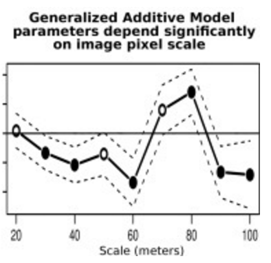
We classified land cover types from 1940s historical aerial imagery using Object Based Image Analysis (OBIA) and compared these maps with data on recent cover. Few studies have used these kinds of maps to model drivers of cover change, partly due to two statistical challenges: 1) appropriately accounting for spatial autocorrelation and 2) appropriately modeling percent cover which is bounded between 0 and 100 and not normally distributed. We studied the change in woody cover at four sites in California’s North Coast using historical (1948) and recent (2009) high spatial resolution imagery.

Click to read more ...

Wednesday
Dec022015

Mapping relative differences in belowground biomass in wetlands

O’Connell, JL, KB Byrd, and M Kelly. 2015. A Hybrid Model for Mapping Relative Differences in Belowground Biomass and Root:Shoot Ratios Using Spectral Reflectance, Foliar N and Plant Biophysical Data within Coastal Marsh. Remote Sensing 7, 16480-16503

Loadings values of % foliar N from PLS regression of hyperspectral data for Typha spp. Broad-scale estimates of belowground biomass are needed to understand wetland resiliency and C and N cycling, but these estimates are difficult to obtain because root:shoot ratios vary considerably both within and between species. We used remotely-sensed estimates of two aboveground plant characteristics, aboveground biomass and % foliar N to explore biomass allocation in low diversity freshwater impounded peatlands (Sacramento-San Joaquin River Delta, CA, USA). We developed a hybrid modeling approach to relate remotely-sensed estimates of % foliar N (a surrogate for environmental N and plant available nutrients) and aboveground biomass to field-measured belowground biomass for species specific and mixed species models.

Click to read more ...

Wednesday
Feb252015

Teleconnections between land use and wildfire

Butsic, V., M. Kelly and M. A. Moritz. Land Use and Wildfire: A Review of Local Interactions and Teleconnections. Land 2015, 4(1), 140-156; doi:10.3390/land4010140

Fire is a naturally occurring process of most terrestrial ecosystems as well as a tool for changing land use. Since the beginning of history humans have used fire as a mechanism for creating areas suitable for agriculture and settlement. As fires threaten human dominated landscapes, fire risk itself has become a driver of landscape change, impacting landscapes through land use regulations and fire management. Land use changes also influence fire ignition frequency and fuel loads and hence alters fire regimes. The impact of these changes is often exacerbated as new land users demand alternative fire management strategies, which can impact land cover and management far from where land use change has actually occurred. This creates nuanced land use teleconnections between source areas for fires and economic cores, which demand and fund fire protection.

Click to read more ...

Tuesday
Jan202015

20th-century shifts in forest structure in California - evidence from the VTM dataset

McIntyre, P. J., J. H. Thorne, C. R. Dolanc, A. L. Flint, L. E. Flint, M. Kelly and D. D. Ackerly. 2015. Twentieth-century shifts in forest structure in California: Denser forests, smaller trees, and increased dominance of oaks. Proceedings of the National Academy of Sciences 112(5): 1458-1463

change in climate water deficit (left) and change in large trees (right)We document changes in forest structure between historical (1930s) and contemporary (2000s) surveys of California vegetation through comparisons of tree abundance and size across the state and within several ecoregions. Across California, tree density in forested regions increased by 30% between the two time periods, whereas forest biomass in the same regions declined, as indicated by a 19% reduction in basal area. These changes reflect a demographic shift in forest structure: larger trees (>60 cm diameter at breast height) have declined, whereas smaller trees (<30 cm) have increased. Large tree declines were more severe in areas experiencing greater increases in climatic water deficit since the 1930s, based on a hydrologicmodel of water balance for historical climates through the 20th century.

Click to read more ...

Thursday
Dec182014

The need to validate remote sensing of crime

Kelly, A. and M. Kelly. 2014. Validating the remotely sensed geography of crime: a review of emerging issues. Remote Sensing 6(12): 12723-12751

This paper explores the existing literature on the active detection of crimes using remote sensing technologies.  The paper reviews sixty-one studies that use remote sensing to actively detect crime.  Considering the serious consequences of misidentifying crimes or sites of crimes (e.g. opening that place and its residents up to potentially needless intrusion, intimidation, surveillance, or violence), the authors were surprised to find a lack of rigorous validation of the remote sensing methods utilized in these studies.

Click to read more ...

Tuesday
Dec092014

Spatial pattern of BMI among adults in Northern California 

Laraia, B. A., S. D. Blanchard, A. J. Karter, J. C. Jones-Smith, M. Warton, E. Kersten, M. Jerrett, H. H. Moffet, N. Adler, D. Schillinger, and M. Kelly. 2014. Spatial pattern of Body Mass Index among adults in the Diabetes Study of Northern California (DISTANCE). International Journal of Health Geographics 13:48 doi:10.1186/1476-072X-13-48

clustering of high and low BMIThe role that environmental factors, such as neighborhood socioeconomics, food, and physical environment, play in the risk of obesity and chronic diseases is not well quantified. Understanding how spatial distribution of disease risk factors overlap with that of environmental (contextual) characteristics may inform health interventions and policies aimed at reducing the environment risk factors.

Click to read more ...

Monday
Jun232014

Quantifying ladder fuels with lidar

Kramer, H. A., B. Collins, M. Kelly, S. Stephens. Quantifying ladder fuels in forests: a new approach using LiDAR. Forests 5:1432-1453

We investigated the relationship between LiDAR and ladder fuels in the northern Sierra Nevada, California USA. LiDAR has only been used to address this question peripherally and in only a few instances. After establishing that landscape fuel treatments reduced canopy and ladder fuels at our site, we tested which LiDAR-derived metrics best differentiated treated from untreated areas. The percent cover between 2 and 4 m had the most explanatory power to distinguish treated from untreated pixels across a range of spatial scales.

Click to read more ...

Monday
Mar312014

What is "marginal land"? a review of the ways GIS is used to model (and define) "marginal land" for biofuel production

Lewis, S. and M. Kelly. 2014. Mapping the potential for biofuel production on marginal lands: differences in definitions, data and models across scale. International Journal of Geo-Information 3(2), 430-459; doi:10.3390/ijgi3020430

As energy policies mandate increases in bioenergy production, new research supports growing bioenergy feedstocks on marginal lands. Subsequently there has been an increase in published work that uses Geographic Information Systems (GIS) to map the availability of marginal land as a proxy for bioenergy crop potential. However, despite the similarity in stated intent among these works a number of inconsistencies remain across studies that make comparisons and standardization difficult. We reviewed a collection of recent literature that mapped bioenergy potential on marginal lands at varying scales, and found that there is no common working definition of marginal land across all of these works. Specifically we found considerable differences in mapped results that are driven by dissimilarities in definitions, model framework, data inputs, scale and treatment of uncertainty.

Click to read more ...

Monday
Mar102014

Using remote sensing to model biomass accumulation in a wetland plant

Some of the reflectance spectra for S. acutusO’Connell, J.L., K.B. Byrd, M. Kelly. 2014. Remotely-sensed indicators of N-related biomass allocation in Schoenoplectus acutus. PLOS One. 9(3):e90870

Coastal marshes depend on belowground biomass of roots and rhizomes to contribute to peat and soil organic carbon, accrete soil and alleviate flooding as sea level rises. For nutrient-limited plants, eutrophication has either reduced or stimulated belowground biomass depending on plant biomass allocation response to fertilization. Within a freshwater wetland impoundment receiving minimal sediments, we used experimental plots to explore growth models for a common freshwater macrophyte, Schoenoplectus acutus. We used N-addition and control plots (4 each) to test whether remotely-sensed vegetation indices could predict leaf N concentration, root:shoot ratios and belowground biomass of S. acutus. N-addition did not alter whole plant, but reduced belowground biomass 36% and increased aboveground biomass 71%. We correlated leaf N concentration with known N-related spectral regions using all possible normalized difference (ND), simple band ratio (SR) and first order derivative ND (FDN) and SR (FDS) vegetation indices.

Click to read more ...

Friday
Feb142014

SLR and wetlands in the SF Bay

The resilience of four marshes examined in this paper.Schile, L.M., J.C. Callaway, J.T. Morris, D. Stralberg, V. T. Parker, and M. Kelly. 2014. Modeling tidal marsh distribution with sea-level rise: evaluating the role of vegetation and upland habitat in marsh resiliency. PLOS One 9(2): e88760

Tidal marshes maintain elevation relative to sea level through accumulation of mineral and organic matter, yet this dynamic accumulation feedback mechanism has not been modeled widely in the context of accelerated sea-level rise. Uncertainties exist about tidal marsh resiliency to accelerated sea-level rise, reduced sediment supply, reduced plant productivity under increased inundation, and limited upland habitat for marsh migration. We examined marsh resiliency under these uncertainties using the Marsh Equilibrium Model, a mechanistic, elevation-based soil cohort model, using a rich data set of plant productivity and physical properties from sites across the estuarine salinity gradient. Four tidal marshes were chosen along this gradient: two islands and two with adjacent uplands. Varying century sea-level rise (52, 100, 165, 180 cm) and suspended sediment concentrations (100%, 50%, and 25% of current concentrations), we simulated marsh accretion across vegetated elevations for 100 years, applying the results to high spatial resolution digital elevation models to quantify potential changes in marsh distributions.

Click to read more ...