publications by year

Selected Publications

My CV can be found here, my Google Scholar page is here and my Research Gate page is here. Links to directly downloadable papers are provided when possible - these are for individual use only; links to journals are also provided, but might not be available to users without campus library access. All papers are available upon request.

Tuesday
Dec092014

Spatial pattern of BMI among adults in Northern California 

Laraia, B. A., S. D. Blanchard, A. J. Karter, J. C. Jones-Smith, M. Warton, E. Kersten, M. Jerrett, H. H. Moffet, N. Adler, D. Schillinger, and M. Kelly. 2014. Spatial pattern of Body Mass Index among adults in the Diabetes Study of Northern California (DISTANCE). International Journal of Health Geographics 13:48 doi:10.1186/1476-072X-13-48
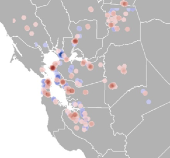
clustering of high and low BMIThe role that environmental factors, such as neighborhood socioeconomics, food, and physical environment, play in the risk of obesity and chronic diseases is not well quantified. Understanding how spatial distribution of disease risk factors overlap with that of environmental (contextual) characteristics may inform health interventions and policies aimed at reducing the environment risk factors.

Click to read more ...

Saturday
Nov292014

The role of private landowner in sustaining ecosystem services in California

Ferranto, S., L. Huntsinger and M. Kelly. 2014. Sustaining ecosystem services from private lands in California: the role of the landowner. Rangelands 36(5): 44-51

Forty percent, 13 million ha, of California’s forests and rangelands are privately owned. Deserts and forests are mostly in government ownership, while the state’s Mediterranean rangelands are largely in private hands: more than 80% of hardwood rangelands and annual grasslands are in private ownership. Landowner participation in sustaining ecosystem services means conservation initiatives need to build on landowner management objectives, practices, and goals.

Click to read more ...

Monday
Aug042014

Lidar-derived volume metrics for aboveground biomass estimation in conifer stands

individual trees in the lidar cloudTao, S., Li, L., Q. Guo, L. Li, B. Xue, M. Kelly, W. Li, G. Xu, and Y. Su. 2014. Airborne Lidar-derived volume metrics for aboveground biomass estimation: A comparative assessment for conifer stands. Agriculture and Forest Management 198–199: 24–3

Estimating aboveground biomass (AGB) is essential to quantify the carbon balance of terrestrial ecosystems, and becomes increasingly important under changing global climate. Volume metrics of individual trees, for example stem volume, have been proven to be strongly correlated to AGB. In this paper, we compared a range of airborne Lidar-derived volume metrics (i.e. stem volume, crown volume under convex hull, and crown volume under Canopy Height Model (CHM)) to estimate AGB. In addition, we evaluated the effect of horizontal crown overlap (which is often neglected in Lidar literature) on the accuracy of AGB estimation by using a hybrid method that combined marker-controlled watershed segmentation and point cloud segmentation algorithms.

Click to read more ...

Monday
Jun232014

Quantifying ladder fuels with lidar

Kramer, H. A., B. Collins, M. Kelly, S. Stephens. Quantifying ladder fuels in forests: a new approach using LiDAR. Forests 5:1432-1453

We investigated the relationship between LiDAR and ladder fuels in the northern Sierra Nevada, California USA. LiDAR has only been used to address this question peripherally and in only a few instances. After establishing that landscape fuel treatments reduced canopy and ladder fuels at our site, we tested which LiDAR-derived metrics best differentiated treated from untreated areas. The percent cover between 2 and 4 m had the most explanatory power to distinguish treated from untreated pixels across a range of spatial scales.

Click to read more ...

Monday
May052014

Mapping wetland biomass with three remote sensors

Byrd, K.B., J.L. O'Connell, S. Di Tommaso, and M. Kelly. 2014. Evaluation of sensor types and environmental controls on mapping biomass of coastal marsh emergent vegetation. Remote Sensing of Environment 149: 166-180

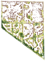
One of our biomass maps, this one from Mayberry slough

We modeled biomass of emergent vegetation with field spectrometer and satellite data from Landsat, Hyperion and WorldView-2 sensors. Use of narrowbands did not significantly improve biomass predictions over broadbands. Water inundation interacting with plant structure controlled biomass model accuracy. Shortwave infrared bands and multi-temporal datasets improved biomass prediction. These types of maps will track Blue Carbon, sea level rise and land use effects in coastal marshes.

Pdf download. Journal link.

Key words: emergent vegetation, hyperspectral sensor, field spectroscopy, multispectral sensor, water inundation, Blue Carbon, wetland management, error reporting.

Monday
Mar312014

What is "marginal land"? a review of the ways GIS is used to model (and define) "marginal land" for biofuel production

Lewis, S. and M. Kelly. 2014. Mapping the potential for biofuel production on marginal lands: differences in definitions, data and models across scale. International Journal of Geo-Information 3(2), 430-459; doi:10.3390/ijgi3020430

As energy policies mandate increases in bioenergy production, new research supports growing bioenergy feedstocks on marginal lands. Subsequently there has been an increase in published work that uses Geographic Information Systems (GIS) to map the availability of marginal land as a proxy for bioenergy crop potential. However, despite the similarity in stated intent among these works a number of inconsistencies remain across studies that make comparisons and standardization difficult. We reviewed a collection of recent literature that mapped bioenergy potential on marginal lands at varying scales, and found that there is no common working definition of marginal land across all of these works. Specifically we found considerable differences in mapped results that are driven by dissimilarities in definitions, model framework, data inputs, scale and treatment of uncertainty.

Click to read more ...

Monday
Mar102014

Using remote sensing to model biomass accumulation in a wetland plant

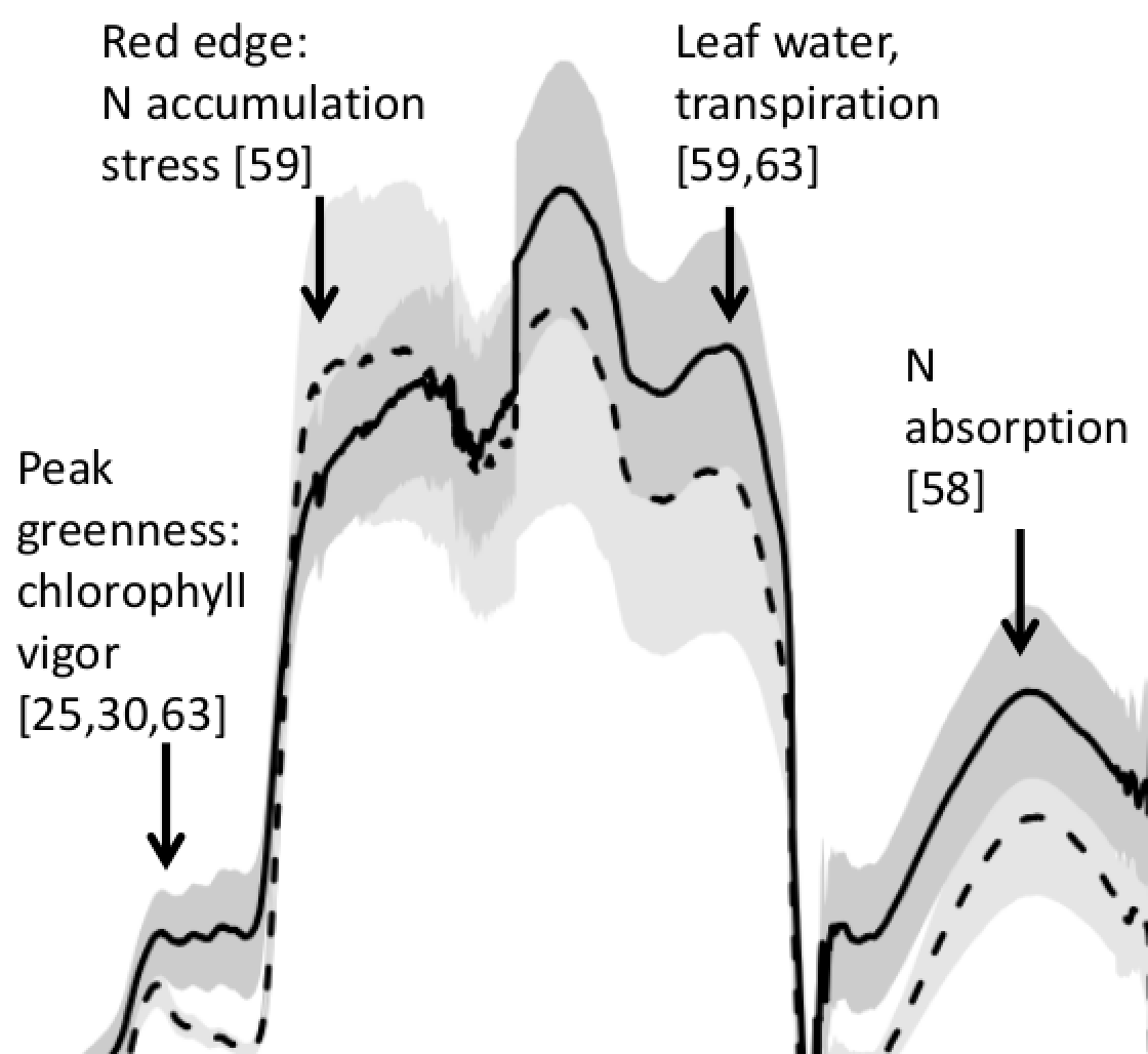
Some of the reflectance spectra for S. acutusO’Connell, J.L., K.B. Byrd, M. Kelly. 2014. Remotely-sensed indicators of N-related biomass allocation in Schoenoplectus acutus. PLOS One. 9(3):e90870

Coastal marshes depend on belowground biomass of roots and rhizomes to contribute to peat and soil organic carbon, accrete soil and alleviate flooding as sea level rises. For nutrient-limited plants, eutrophication has either reduced or stimulated belowground biomass depending on plant biomass allocation response to fertilization. Within a freshwater wetland impoundment receiving minimal sediments, we used experimental plots to explore growth models for a common freshwater macrophyte, Schoenoplectus acutus. We used N-addition and control plots (4 each) to test whether remotely-sensed vegetation indices could predict leaf N concentration, root:shoot ratios and belowground biomass of S. acutus. N-addition did not alter whole plant, but reduced belowground biomass 36% and increased aboveground biomass 71%. We correlated leaf N concentration with known N-related spectral regions using all possible normalized difference (ND), simple band ratio (SR) and first order derivative ND (FDN) and SR (FDS) vegetation indices.

Click to read more ...

Thursday
Mar062014

Mapping potential for switchgrass as a biofuel in the US

One model outcome from the analysis.Lewis, S.M., G. Fitts, M. Kelly, L. Dale. 2014. A fuzzy logic-based spatial suitability model for drought-tolerant switchgrass in the United States. Computers and Electronics in Agriculture 103:39-47

Switchgrass (Panicum virgatum) has been targeted by the U.S. Department of Agriculture as an exemplary bioenergy crop, however it requires a significant amount of water and experiences reduced yields in water-stressed conditions. To avoid competition for prime agricultural areas, lands that receive adequate rainfall but are marginal due to highly variable timing of rain are potentially ideal locations to grow drought-tolerant biofuels. As scientists develop a modified variety of switchgrass that can withstand periods of drought while not substantially affecting overall yield, it is important to identify the potential geographical niche for this xerophytic crop to maximize its environmental and economic sustainability. This project uses a spatial suitability modeling approach that incorporates fuzzy logic and utilizes both physical and economic variables.

Click to read more ...

Friday
Feb142014

SLR and wetlands in the SF Bay

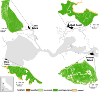
The resilience of four marshes examined in this paper.Schile, L.M., J.C. Callaway, J.T. Morris, D. Stralberg, V. T. Parker, and M. Kelly. 2014. Modeling tidal marsh distribution with sea-level rise: evaluating the role of vegetation and upland habitat in marsh resiliency. PLOS One 9(2): e88760

Tidal marshes maintain elevation relative to sea level through accumulation of mineral and organic matter, yet this dynamic accumulation feedback mechanism has not been modeled widely in the context of accelerated sea-level rise. Uncertainties exist about tidal marsh resiliency to accelerated sea-level rise, reduced sediment supply, reduced plant productivity under increased inundation, and limited upland habitat for marsh migration. We examined marsh resiliency under these uncertainties using the Marsh Equilibrium Model, a mechanistic, elevation-based soil cohort model, using a rich data set of plant productivity and physical properties from sites across the estuarine salinity gradient. Four tidal marshes were chosen along this gradient: two islands and two with adjacent uplands. Varying century sea-level rise (52, 100, 165, 180 cm) and suspended sediment concentrations (100%, 50%, and 25% of current concentrations), we simulated marsh accretion across vegetated elevations for 100 years, applying the results to high spatial resolution digital elevation models to quantify potential changes in marsh distributions.

Click to read more ...

Sunday
Dec152013

Geographic Object-Based Image Analysis – Towards a new paradigm

A forest stand with sudden oak death: three common image spatial resolutions: 30 m, 4 m and 1 m.Blaschke, T., G.J. Hay, M. Kelly, S. Lang, P. Hofmann, E. Addink, R. Feitosa, F. Van Der Meer, H. Van Der Werff, F. Van Coillie, D. Tiede. 2014. Geographic Object-based Image Analysis: a new paradigm in Remote Sensing and Geographic Information Science. ISPRS International Journal of Photogrammetry and Remote Sensing 87(1), 180-191.

The amount of scientific literature on (Geographic) Object-based Image Analysis – GEOBIA has been and still is sharply increasing. These approaches to analysing imagery have antecedents in earlier research on image segmentation and use GIS-like spatial analysis within classification and feature extraction approaches. This article investigates these development and its implications and asks whether or not this is a new paradigm in remote sensing and Geographic Information Science (GIScience).

Click to read more ...