publications by year

Selected Publications

My CV can be found here, my Google Scholar page is here and my Research Gate page is here. Links to directly downloadable papers are provided when possible - these are for individual use only; links to journals are also provided, but might not be available to users without campus library access. All papers are available upon request.

Entries in remote sensing (51)

Friday
Mar302007

Upland land use influence on wetlands

Byrd and Kelly 2006. Wetlands. This study investigated how changes in salt marsh soil properties and topography on sediment fans related to shifts in salt marsh plant community composition in the Elkhorn Slough Watershed, California, USA.

Click to read more ...

Sunday
Dec312006

Automatic registration of airborne images

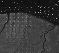
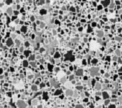
Liu, et al. 2006. Photogrammetric Engineering and Remote Sensing. Deformation vector plots overlaid on areas with high and low texture.Accurate registration of airborne images is challenging because complex local geometric distortions are often involved in image acquisition. We propose a solution to this registration problem in two parts: 1) an area-based method to extract sufficient numbers of well-located control points, 2) we use the extracted control points with local transformation models to register multi-temporal airborne images.

Click to read more ...

Tuesday
Oct312006

Isolating individual trees in a savanna woodland using lidar

Chen et al. 2006. Photogrammetric Engineering and Remote Sensing. Individual trees delineated.This study presents a new method of detecting individual treetops from lidar data and applies marker-controlled watershed segmentation into isolating individual trees in savanna woodland. The treetops were detected by searching local maxima in a canopy maxima model (CMM) with variable window sizes.

Click to read more ...

Monday
Jul312006

Obia for detailed vegetation mapping

Yu et al. 2006. Photogrammetric Engineering and Remote Sensing. In this paper, we evaluate the capability of the high spatial resolution airborne Digital Airborne Imaging System (DAIS) imagery for detailed vegetation classification at the alliance level with the aid of ancillary topographic data. Image objects as minimum classification units were generated through the Fractal Net Evolution Approach (FNEA) segmentation using eCognition software. For each object, 52 features were calculated including spectral features, textures, topographic features, and geometric features. After statistically ranking the importance of these features with the classification and regression tree algorithm (CART), the most effective features for classification were used to classify the vegetation.

Click to read more ...

Wednesday
May312006

Spatial‐temporal monitoring of forest disease dynamics

Liu et al. 2006. Remote Sensing of Environment. Traditional mapping approaches using per-pixel, single-date image classifications have not generated consistently satisfactory results. Incorporation of spatial–temporal contextual information can improve these results. In this paper, we propose a spatial–temporally explicit algorithm to classify individual images using the spectral and spatial–temporal information derived from multiple co-registered images.

Click to read more ...

Wednesday
Jun292005

Decadal changes in a Pacific estuary

Byrd et al. 2005. GIScience and Remote Sensing. We used historic aerial photographs with manual and automated image classification techniques to discern decadal-scale changes to salt marshes in Elkhorn Slough, California caused by off-farm sedimentation from 1971 to 2001. Change detection identified a process of plant succession that led to arroyo willow encroachment into pickleweed marsh.

Click to read more ...

Tuesday
May312005

Mapping oak mortality using high res CIR imagery

Kelly, et al. 2004. Photogrammetric Engineering and Remote Sensing. Supervised, unsupervised, and “hybrid” classification methods were evaluated for their accuracy in discriminating dead and dying tree crowns from bare areas and the surrounding forest mosaic utilizing 1-m ADAR imagery covering both tanoak/redwood forest and mixed hardwood stands. In both study areas the hybrid classifier significantly outperformed the other methods.

Click to read more ...

Friday
Dec312004

Geospatial informatics for management of Sudden Oak Death

Kelly, et al. 2004. Photogrammetric Engineering and Remote Sensing. For a geographer viewing the early days of the SOD epidemic, there were several intriguing spatial aspects on which a monitoring system could be built, including: 1) disease impact was clearly visible at multiple spatial scales, making remote sensing useful in the monitoring process; 2) disease spread and consequent mortality were patchy at landscape scales, making spatial analysis useful; 3) the disease appeared to be spatially regulated, making accurate spatial data collected using GPS and maintained and mapped using GIS critical; and 4) public awareness and concern about the disease were high, and public participation was needed in the monitoring/tracking process, making webGIS and cartography immediately useful tools for information distribution and management assistance.

Click to read more ...

Monday
Jul262004

Mapping diseased oak trees using ADAR imagery

Kelly and Liu. 2004. Geocarto International. We investigated the ability of high spatial-resolution 4-band imagery (Airborne Digital Acquisition and Registration - ADAR) to discern moisture stress in trees affected by Sudden Oak Death (SOD). The results suggest an inability to automate mapping of moisture stress in oaks using ADAR imagery, and limited success in using methods that require extensive field data.

Click to read more ...

Friday
Oct312003

Spectral absorption and water status in coast live oak leaves

Pu, R., S. Ge, N. M. Kelly, and P. Gong. 2003. International Journal of Remote Sensing. A total of 139 reflectance spectra (between 350 and 2500 nm) from coast live oak (Quercus agrifolia) leaves were measured in the laboratory with a spectrometer. Correlation analysis was conducted between absorption features, three-band ratio indices derived from the spectra and corresponding relative water content (RWC, %) of oak leaves.

Click to read more ...